Active Query Sensing for Mobile Location Search
Summary
While much exciting progress is being made in mobile
visual search, one important question has been left
unexplored in all current systems. When the first query
fails to find the right target (up to 50% likelihood),
how should the user form his/her search strategy in the
subsequent interaction? We propose a novel Active Query
Sensing system to suggest the best way for sensing the
surrounding scenes while forming the second query for
location search. This work may open up an exciting new
direction for developing interactive mobile media
applications through innovative exploitation of active
sensing and query formulation.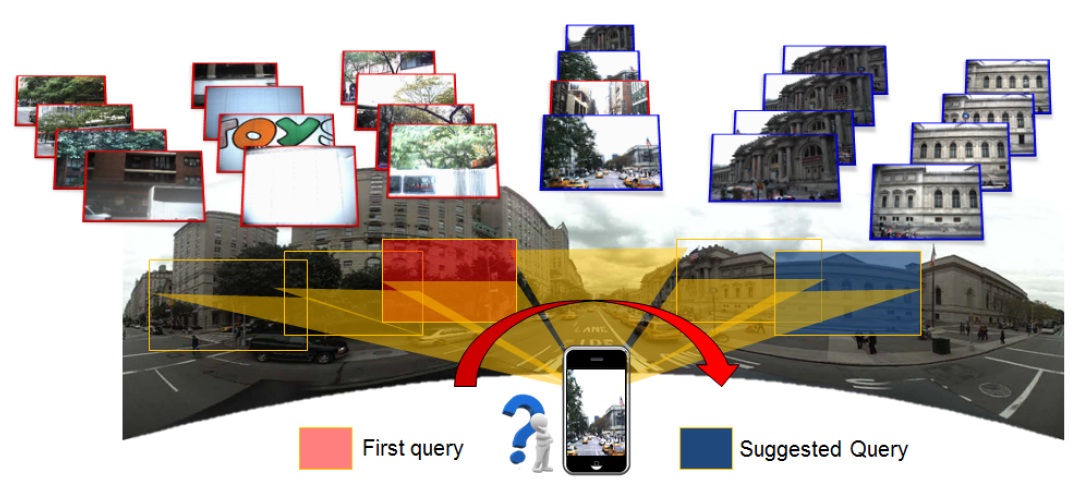
Our proposed framework is general. It can be extended
and applied to mobile visual search of targets of
multi-view references, such as the example shown below.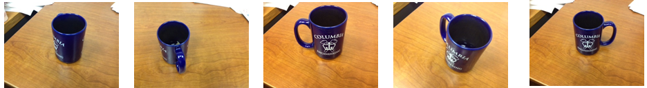
System Architecture
The basic idea of AQS is to use the first query as
"probe" to narrow down the solution space. And the
subsequent query views should be chosen in order to
maximally reduce the location search uncertainty. We
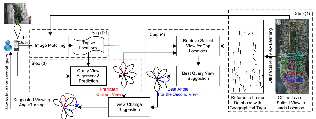
accomplish the goal by developing several unique
components – an offline process for analyzing the
saliency of the views associated with each geographical
location based on score distribution modeling,
predicting the visual search precision of individual
views and locations, an online process for estimating
the view of an unseen query, and suggesting the best
subsequent view change.
Performance Evaluation
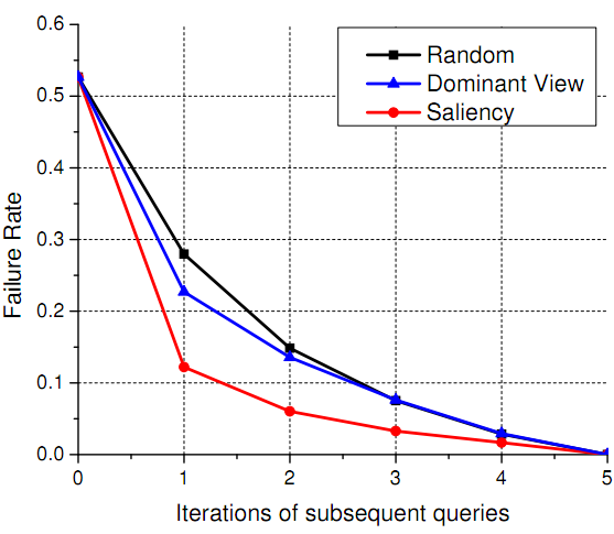
The figure below shows failure rates over successive
query iterations based on different active query sensing
strategies. Using a scalable visual search system
implemented over a NYC street view data set (0.3 million
images),
we show the proposed method (the curve with label
"Saliency") can achieve a performance gain as high as
two folds, reducing the failure rate of mobile location
search from 28% to only 12% after the second query.
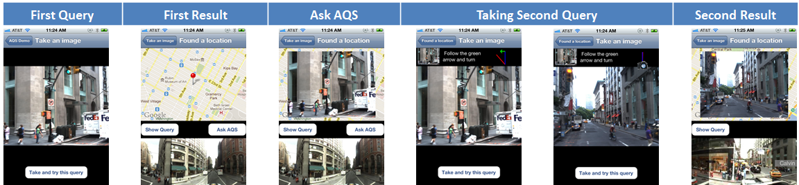
User Interface
We have implemented an end-to-end complete prototype for the proposed AQS system, including an iPhone mobile client, communication modules, and the image matching and retrieval server. The interfaces allow users to visualize search results by combining both panorama image and map. We have also designed an intuitive mechanism to show the user the best view angle and required camera rotation when taking the next query. Snapshots of the mobile user interfaces are shown below.
Acknowledgement
We would like to thank NAVTEQ for providing the NYC image data set, Dr. Xin Chen and Dr. Jeff Bach for their generous help.
People
Felix X. Yu, Rongrong Ji, Tongtao Zhang, Shih-Fu ChangPublications
-
Felix X. Yu, Rongrong Ji, Shih-Fu Chang. Active
Query Sensing for mobile location search.
In Proceeding
of ACM International Conference on Multimedia (ACM MM),
2011.

 [Slides] [Poster]
 -
Felix X. Yu, Rongrong Ji, Tongtao Zhang, Shih-Fu Chang. A
mobile location search system with Active Query Sensing.
In Proceeding
of ACM International Conference on Multimedia (ACM MM),
2011.
[Demo Video] [Poster]